

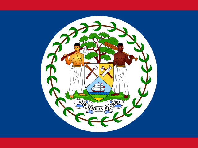
English-speaking Caribbean
Belize
An English-speaking Caribbean nation in Central America, with the world's second-largest barrier reef.
At a glance
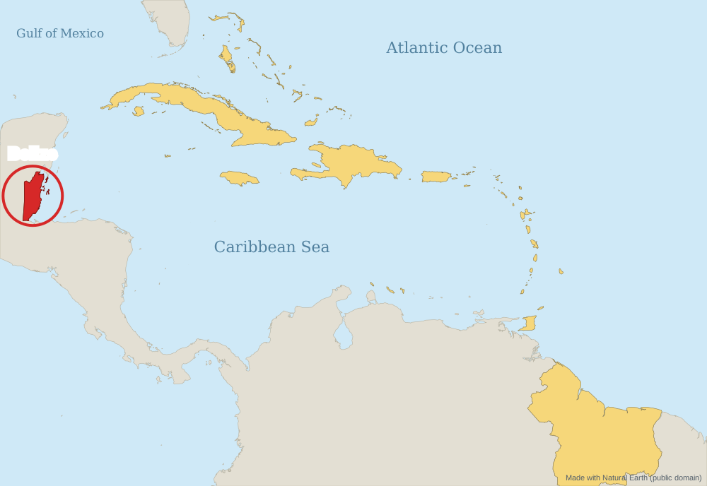
Key dates
Flag and national symbols
Brief history
Belize was a heartland of the Maya; great cities like Caracol were built here.[2][10]
British settlers cut logwood. In 1798 they fought the Spanish at the Battle of St. George's Caye. The territory became the Crown colony of British Honduras in 1862 and was renamed Belize in 1973.[2][5]
Independence and government
Belize became independent on 21 September 1981, with George Price as first Prime Minister. It is the only Central American country where English is the official language.[1][2][8]
Notable people
- George Price: Led Belize to independence and was its first Prime Minister.[8]
- Samuel Haynes: Wrote the words of the national anthem, “Land of the Free”.[7]
Use the sources to find more Belizean leaders and artists.[2]
Geography
Belize is on the Caribbean coast of Central America, between Mexico and Guatemala. The Belize Barrier Reef is the second-largest barrier reef in the world and a UNESCO World Heritage Site.[1][3]
The Great Blue Hole, a giant underwater sinkhole at Lighthouse Reef, was made famous by Jacques Cousteau.[4]
Culture, festivals, music and food
Garifuna
Garifuna language, dance and music are recognised by UNESCO (2001). Garifuna Settlement Day is 19 November.[6]
Many peoples
Creole, Mestizo, Maya, Garifuna, Mennonite and other communities share Belize.[2]
Food
Rice and beans, often cooked with coconut milk, is a traditional midday meal.[2]
Primary School Belize in a nutshell
- Belize is in Central America but faces the Caribbean Sea. People speak English there. Its capital is Belmopan.[1][2]
Now try the quiz, or print the fact sheet.
Secondary School Going deeper
A new capital
Why did Belize move its capital inland to Belmopan after Hurricane Hattie?[9]
Protecting the reef
What threatens the Belize Barrier Reef, and how is it protected?[3]
Research questions
- Why is Belize part of the Caribbean community even though it is in Central America?
- What can Maya sites like Caracol tell us about Belize before Europeans arrived?
Tip: use at least two sources and note where each fact comes from. The sources below are a good place to start.
Quick quiz
Choose an answer, then press Check. You will find out straight away. Nothing is saved or sent anywhere.
Fact sheet
A one-page summary of Belize to print or save as a PDF.
Sources
Numbers in square brackets, like [1], show which source each fact comes from. All sources were checked on 14 November 2026.
- The World Factbook: Belize (final edition, archived January 2026). Central Intelligence Agency (US). web.archive.org/web/2026/https://www.cia.gov/the-world-factbook/countr… (opens in a new tab)
- Belize. Wikipedia. en.wikipedia.org/wiki/Belize (opens in a new tab)
- Belize Barrier Reef. Wikipedia. en.wikipedia.org/wiki/Belize_Barrier_Reef (opens in a new tab)
- Great Blue Hole. Wikipedia. en.wikipedia.org/wiki/Great_Blue_Hole (opens in a new tab)
- Battle of St. George's Caye. Wikipedia. en.wikipedia.org/wiki/Battle_of_St._George%27s_Caye (opens in a new tab)
- Garifuna. Wikipedia. en.wikipedia.org/wiki/Garifuna (opens in a new tab)
- Land of the Free (anthem). Wikipedia. en.wikipedia.org/wiki/Land_of_the_Free_(anthem) (opens in a new tab)
- George Cadle Price. Wikipedia. en.wikipedia.org/wiki/George_Cadle_Price (opens in a new tab)
- Belmopan. Wikipedia. en.wikipedia.org/wiki/Belmopan (opens in a new tab)
- Caracol. Wikipedia. en.wikipedia.org/wiki/Caracol (opens in a new tab)
Last reviewed: 14 November 2026 (facts checked against the sources above by the Caribbean Cup of Tea team). Educator review: pending. This is a pilot page awaiting review by a teacher or education specialist.